
DISCOVER THE LOCATION
OF THE SEAGRASS MEADOWS IN THE SADO ESTUARY
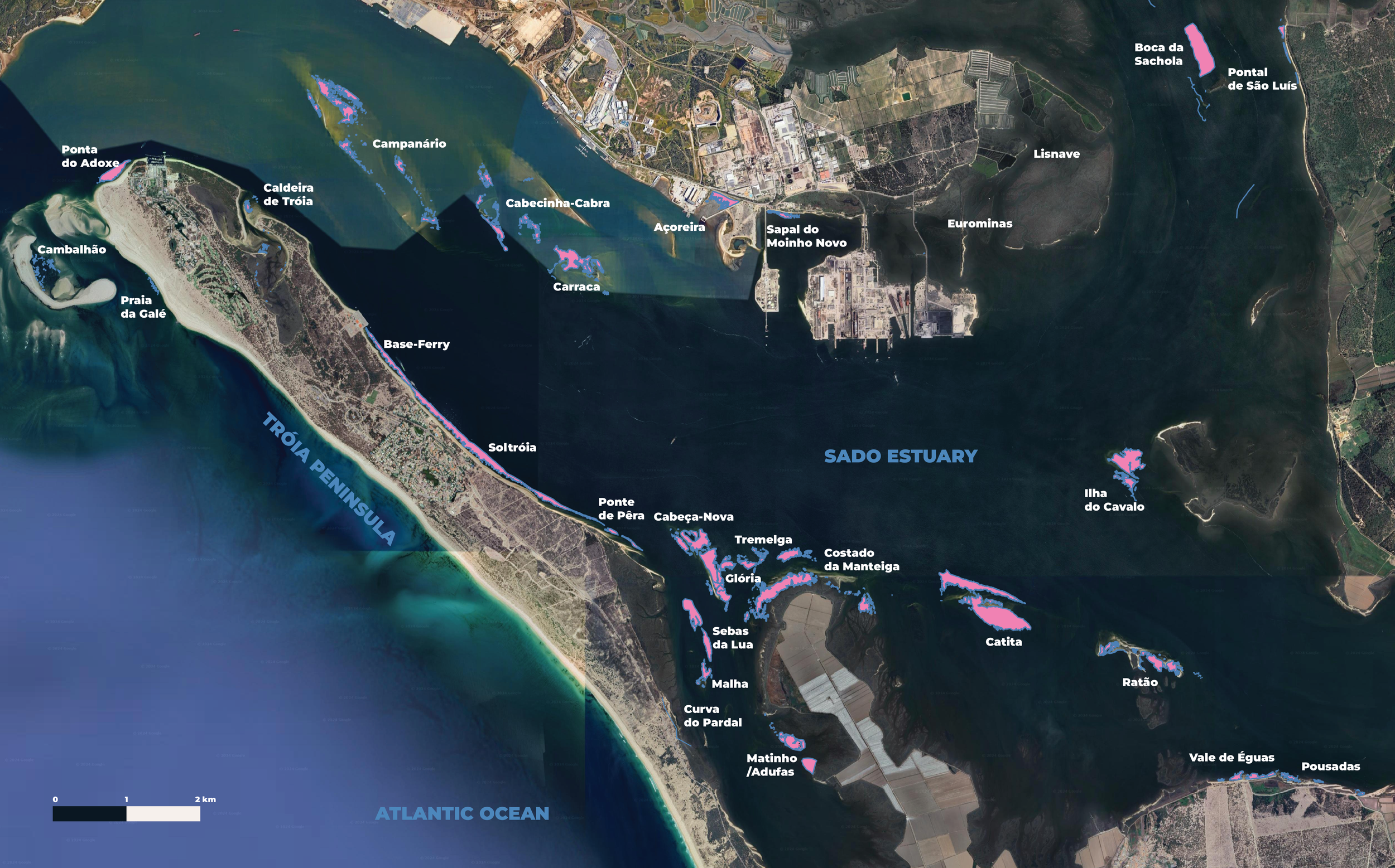
SEAGRASS MEADOWS OF THE SADO ESTUARY
This is the mapping of the seagrass meadows in the Sado estuary carried out by Ocean Alive since 2019. In total, we have identified about 31 meadows and mapped 29.
The minimum area mapped by Ocean Alive is 190.91 hectares, which roughly represents a blue carbon stock of 3,823.93 tons of carbon per 10 cm of sediment.*
Over the past four years, we recorded an increase of 35.62 hectares in the total area of the nine seagrass meadows monitored using the same methods**, a positive sign of the recovery of these marine forests in the Sado estuary.
In the most recent mapping season (2023/2024), we mapped 19 seagrass meadows using six methodologies: GPS marking on foot, by boat, freediving, scuba diving, and from drone and satellite images. The mappings were conducted by our team in collaboration with four Guardians of the Sea, seagrass meadow monitors.
Learn more about the Guardians of the Meadows Program and become part of preserving these marine forests and the biodiversity they support!
*Value based on the maximum estimate of average carbon stock recorded in the first 10 cm of sediment and plant biomass; assumes 100% meadow coverage, based on Z. noltei meadows from Ria de Aveiro, source: Sousa A.I. et al., 2019. Blue Carbon stock in Zostera noltei meadows at Ria de Aveiro coastal lagoon (Portugal) over a decade. Scientific Reports, 9:14387.
**Identification of the 9 seagrass meadows mapped with the same methods: Cabeça Nova; Carraca; Catita; Costado de Manteiga; Glória; Ilha do Cavalo; Tremelga; and Vale de Éguas.